
Berkas:Philippines relief location map (Mindanao).svg

Ukuran pratayang PNG ini dari berkas SVG ini: 656 x 486 piksel resolusi uweewo:320 x 237 piksel | 640 x 474 piksel | 1.024 x 759 piksel | 1.280 x 948 piksel | 2.560 x 1.897 piksel
Berkas asli (Berkas SGV, nominal 656 x 486 piksel, damango berkas:2,21 MB)
.svg)
Limbu'o
| Deskripsi |
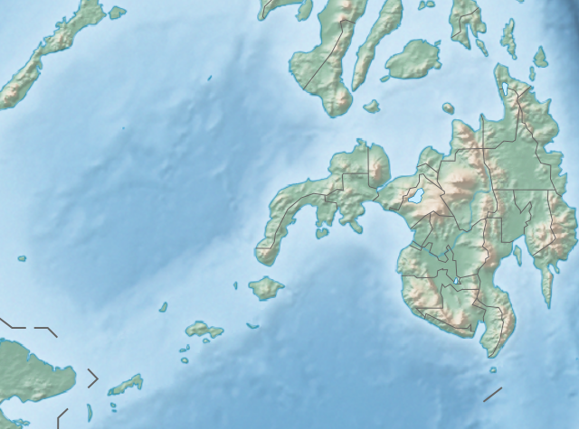
English: Physical location map of the Philippines (Mindanao)
Equirectangular projection based on the parallel of 10°43' N
|
| Tanggal | |
| Bungo | File:Philippines location map (square).svg |
| Ta ohu'uwo | User:Hellerick |
| Versi lainnya |
This file was derived from: Philippines relief location map (square).svg: .svg) |
.svg)
Tayadu lisensi
Berkas botiye lisensiliyo to walungo Creative Commons Atribusi-Motayade Odelo 3.0 Diyalu Adaptasi lisensi
- Yi'o mowali
- mopotayadu – mohemi wawu mopotayadu karaja botiye to nga'amila rupa
- Adaptasi – monguba, moromba wawu mohutu mali uweewo lonto berkas botiye
- Payu buto'o botiya
- atribusi – Yi'o musti moluladu tanggulo u banari mongohi wumbuta wolo lisensi, wawu mopolele ma yilomoli'o.
Yi'o mowali mohutu woloolo u otohilamu, dabo jamowali mopolele ta longohi lisensi akoro wolemu meyalo u pilohutumu.
- Mopotayadu odelo odiye – Wonu Yi'o moromba, momoli'o meyalo mohutu uweewo lo materi botiye, Yi'o musti mopololadu kontribusi olemu to walungo same or compatible license wolo materi asli.
Riwāyati lo berkas
Klik to tanggal/wakutu momilohe berkas to saa'ati botiye.
| Tanggal/Wakutu | Gambari kiki'o | Dimensi | Ta ohu'uwo | Lo'iya | |
|---|---|---|---|---|---|
| baharu | 27 Oktober 2017 22.36 | | 656 × 486 (2,21 MB) | Mliu92 | Updated crop to add missing island. |
| 27 Oktober 2017 01.23 |  | 573 × 573 (2,21 MB) | Mliu92 | User created page with UploadWizard |
Berkas u pilopohuna
Diya'a halaman u owumbuta ode berkas botiye
Pilopohuna berkas global
Wiki uweewo hemomake berkas botiya
- Pilopohuna to bcl.wikipedia.org
- Pilopohuna to bn.wikipedia.org
- Pilopohuna to en.wikipedia.org
- Sulu Sea
- Moro Gulf
- Mount Apo
- Davao Gulf
- Iligan Bay
- Panguil Bay
- Bud Dajo
- Mount Butung
- Agusan River
- Lake Lanao
- Rio Grande de Mindanao
- Butuan Bay
- Mount Agad-Agad
- Mount Hibok-Hibok
- Mount Makaturing
- Mount Matutum
- Musuan Peak
- Agus River
- Sibuguey Bay
- Illana Bay
- Mount Sumagaya
- Dinagat Island
- Davao River
- Leonard Kniaseff
- Mount Kitanglad
- Macajalar Bay
- Pulangi River
- Cagayan River (Mindanao)
- Mount Dulang-dulang
- Tagoloan River
- Lake Buluan
- Lake Wood (Philippines)
- Lake Dapao
- Mount Malindang
- Mount Kalatungan
- Latukan
- Mount Balatukan
- Mount Hamiguitan
- Mount Baya
- Agusan Marsh Wildlife Sanctuary
- Camp General Basilio Navarro
- 2010 Mindanao earthquakes
- Manupali River
Bilohi ngohuntuwa ta lopohuna global lo berkas botiye.
.svg)
.svg)