
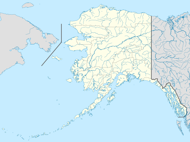
Berkas:USA Alaska location map.svg

Ukuran pratayang PNG ini dari berkas SVG ini: 800 x 598 piksel resolusi uweewo:320 x 239 piksel | 640 x 478 piksel | 1.024 x 765 piksel | 1.280 x 956 piksel | 2.560 x 1.912 piksel | 1.553 x 1.160 piksel
Berkas asli (Berkas SGV, nominal 1.553 x 1.160 piksel, damango berkas:1,24 MB)
Limbu'o
| Deskripsi | |
| Tanggal | |
| Bungo | Ilomata lo hihilawo |
| Ta ohu'uwo | Alexrk2 |
| Versi lainnya |
Karya turunan dari berkas ini: Starbucks footprint.png
|


| Open this image as an overlay in Google Earth (Google Maps, Bing) | (Help|Source) |
Tayadu lisensi
Saya, pemilik hak cipta dari karya ini, dengan ini menerbitkan berkas ini di bawah ketentuan berikut:

|
Mowali mohemi, mopotayadu wawu/meyalo momoli'a dokumen botiye wolo syarat-syarat Lisensi Dokumentasi Bebas GNU, Versi 1.2 atau lebih baru yang diterbitkan oleh Free Software Foundation; tanpa Bagian Invarian, tanpa Teks Sampul Depan, dan tanpa Teks Sampul Belakang. Salinan lisensi dimasukkan ke bagian yang berjudul Lisensi Dokumentasi Bebas GNU. |
Berkas ini berlisensi di bawah lisensi Creative Commons Atribusi 3.0 Tanpa Adaptasi
- Yi'o mowali
- mopotayadu – mohemi wawu mopotayadu karaja botiye to nga'amila rupa
- Adaptasi – monguba, moromba wawu mohutu mali uweewo lonto berkas botiye
- Payu buto'o botiya
- atribusi – Yi'o musti moluladu tanggulo u banari mongohi wumbuta wolo lisensi, wawu mopolele ma yilomoli'o.
Yi'o mowali mohutu woloolo u otohilamu, dabo jamowali mopolele ta longohi lisensi akoro wolemu meyalo u pilohutumu.
Yi'o mowali molulawoto lisensi otohilamu
| Annotations | This image is annotated: View the annotations at Commons |
Riwāyati lo berkas
Klik to tanggal/wakutu momilohe berkas to saa'ati botiye.
| Tanggal/Wakutu | Gambari kiki'o | Dimensi | Ta ohu'uwo | Lo'iya | |
|---|---|---|---|---|---|
| baharu | 4 Oktober 2009 03.13 | | 1.553 × 1.160 (1,24 MB) | Alexrk2 | Linien gesäubert |
| 4 Oktober 2009 03.03 |  | 1.553 × 1.160 (1,25 MB) | Alexrk2 | Westlicher Teil korrigiert | |
| 4 Oktober 2009 02.35 |  | 1.553 × 1.160 (1,24 MB) | Alexrk2 | == Beschreibung == {{Information |Description= {{de|Positionskarte von Alaska, USA}} Quadratische Plattkarte, N-S-Streckung 210.0 %. Geographische Begrenzung der Karte: * N: 72.0° N * S: 51.0° N * W: 188.0° W * O: 129.0° W { |
Berkas u pilopohuna
Halaman botiya lopohuna berkas:
Pilopohuna berkas global
Wiki uweewo hemomake berkas botiya
- Pilopohuna to af.wikipedia.org
- Pilopohuna to als.wikipedia.org
- Pilopohuna to an.wikipedia.org
- Pilopohuna to ar.wikipedia.org
- Pilopohuna to ast.wikipedia.org
- Alaska
- Baranof
- Juneau (Alaska)
- Anchorage (Alaska)
- Fairbanks (Alaska)
- Ninilchik (Alaska)
- Islles Aleutianes
- Kodiak (Alaska)
- Golfu d'Alaska
- Monte Denali
- Parque y Reserva Nacionales de les Puertes del Árticu
- Cordal d'Alaska
- Módulu:Mapa de llocalización/datos/Alaska
- Módulu:Mapa de llocalización/datos/Alaska/usu
- Aeropuertu Internacional Ted Stevens Anchorage
- Base de la Fuercia Aérea Eielson
- Islla Semisopochnoi
- St. George (Alaska)
- Islles Pribilof
- St. Paul (Alaska)
- Islla Sitkinak
- Pilopohuna to azb.wikipedia.org
Bilohi ngohuntuwa ta lopohuna global lo berkas botiye.