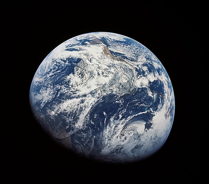
Berkas:As08-16-2593.jpg
Tampilan

Tu'udu lo'u diipo mopobilohu: 678 x 599 piksel resolusi uweewo:272 x 240 piksel | 543 x 480 piksel | 869 x 768 piksel | 1.159 x 1.024 piksel | 2.015 x 1.781 piksel
Berkas asli (2.015 x 1.781 piksel, tu'udu berkas:621 KB, MIME tipe: image/jpeg)
Riwāyati lo berkas
Klik to tanggal/wakutu momilohe berkas to saa'ati botiye.
| Tanggal/Wakutu | Gambari kiki'o | Dimensi | Ta ohu'uwo | Lo'iya | |
|---|---|---|---|---|---|
| baharu | 19 April 2012 01.19 |  | 2.015 × 1.781 (621 KB) | Soerfm | Crop |
| 6 Januari 2008 02.09 |  | 2.458 × 2.458 (411 KB) | Papa November | Uploaded higher res version. Source is on description page | |
| 6 April 2005 11.50 |  | 900 × 900 (96 KB) | Evil Monkey | ===Description=== The first image taken by humans of the whole Earth. Photographed by the crew of Apollo 8 (probably by Bill Anders) the photo shows the Earth at a distance of about 30,000 km. South is at the top |
Berkas u pilopohuna
Diya'a halaman u owumbuta ode berkas botiye
Pilopohuna berkas global
Wiki uweewo hemomake berkas botiya
- Pilopohuna to ar.wikipedia.org
- Pilopohuna to bg.wikipedia.org
- Pilopohuna to bn.wikipedia.org
- Pilopohuna to bn.wikibooks.org
- Pilopohuna to bn.wikiquote.org
- Pilopohuna to br.wikipedia.org
- Pilopohuna to br.wiktionary.org
- Pilopohuna to cy.wikiquote.org
- Pilopohuna to da.wikipedia.org
- Pilopohuna to de.wikipedia.org
- Pilopohuna to de.wikiversity.org
- Pilopohuna to en.wikipedia.org
- 1960s
- Outer space
- User:Ravenswing
- User:Jklin
- User:Big Blue Marble
- User:Paleorthodox
- Portal:Outer space
- User:KrakatoaKatie/Calendar
- User:KrakatoaKatie/CalendarApril
- User:Grimhelm
- User:IjonTichyIjonTichy
- User:UBX/Christ the Logos
- User:Xwayj/sandbox
- User:Revi C.
- User:Luxure/sandbox
- User:Stan traynor
- User:MarsToutatis
- User talk:Coffeeandcrumbs
- User:ZaperaWiki44
- User:Revi C./IRL
- User:Swaggalicious
- User:ItzAviqn
- User:Dr vulpes/sandbox
- User:LittleJellies/sandbox
- User:A Cynical Idealist
- User:Chorchapu/Hello
Bilohi ngohuntuwa ta lopohuna global lo berkas botiye.


