
Berkas:Philippines adm location map.svg

Berkas asli (Berkas SGV, nominal 1.871 x 2.467 piksel, damango berkas:719 KB)
Limbu'o
| Deskripsi |
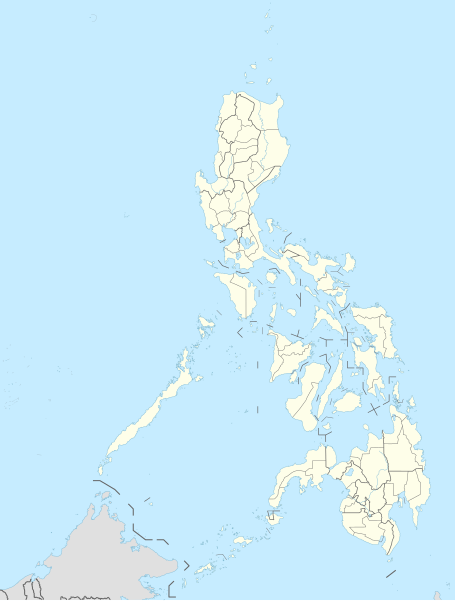
Deutsch: Positionskarte der Philippinen
English: Location map of the Philippines
|
||||||||||||
| Tanggal | |||||||||||||
| Bungo |
Own work using:
|
||||||||||||
| Ta ohu'uwo | NordNordWest | ||||||||||||

|
This map has been made or improved in the German Kartenwerkstatt (Map Lab). You can propose maps to improve as well.
|
Tayadu lisensi
Usage of this file with:

explanatory notes: Legally binding is only the full legalcode. For a free usage I recommend to respect the following licence conditions:
1. Provide my name as given above: NordNordWest,
2. a copy of, or the URI for, the applicable license: https://creativecommons.org/licenses/by-sa/3.0/de/legalcode,
3. the title of the work,
4. in the case of an adaptation, a credit identifying the use of the work in the adaptation.
This license and the rights granted hereunder will terminate automatically upon any breach by you of the terms of this license. Any of the above conditions can be waived if you get permission from the copyright holder. If you have questions or wish differing conditions, please contact me through nnwest or my discussion page ![]() t-online.de
t-online.de
- Yi'o mowali
- mopotayadu – mohemi wawu mopotayadu karaja botiye to nga'amila rupa
- Adaptasi – monguba, moromba wawu mohutu mali uweewo lonto berkas botiye
- Payu buto'o botiya
- atribusi – Yi'o musti moluladu tanggulo u banari mongohi wumbuta wolo lisensi, wawu mopolele ma yilomoli'o.
Yi'o mowali mohutu woloolo u otohilamu, dabo jamowali mopolele ta longohi lisensi akoro wolemu meyalo u pilohutumu.
- Mopotayadu odelo odiye – Wonu Yi'o moromba, momoli'o meyalo mohutu uweewo lo materi botiye, Yi'o musti mopololadu kontribusi olemu to walungo same or compatible license wolo materi asli.

Riwāyati lo berkas
Klik to tanggal/wakutu momilohe berkas to saa'ati botiye.
| Tanggal/Wakutu | Gambari kiki'o | Dimensi | Ta ohu'uwo | Lo'iya | |
|---|---|---|---|---|---|
| baharu | 1 Desember 2023 03.10 | | 1.871 × 2.467 (719 KB) | NordNordWest | corr |
| 1 Desember 2023 03.03 |  | 1.871 × 2.467 (719 KB) | NordNordWest | upd 2022 | |
| 14 Mei 2016 04.19 |  | 1.871 × 2.467 (719 KB) | NordNordWest | == {{int:filedesc}} == {{Information |Description= {{de|1=Positionskarte der Philippinen}} {{en|1=Location map of the Philippines}} {{Location map series N |stretching=103 |top=21.2 |bottom=4.3 |left=114.1 |right=127.3 }} |Source={{Own using}} * United... |
Berkas u pilopohuna
Diya'a halaman u owumbuta ode berkas botiye
Pilopohuna berkas global
Wiki uweewo hemomake berkas botiya
- Pilopohuna to ceb.wikipedia.org
- Leyte (pulo)
- Sidlakang Samar
- Misamis Occidental
- Poro, Sugbo
- Ormoc
- Calbayog
- Tacloban
- Bontoc, Habagatang Leyte
- Padre Burgos, Habagatang Leyte
- Daram, Samar
- Maasin
- Salcedo, Sidlakang Samar
- Alcantara, Sugbo
- San Antonio, Amihanang Samar
- San Roque, Amihanang Samar
- Zumarraga, Samar
- Ajuy, Iloilo
- Tigbauan, Iloilo
- Mabini, Bohol
- Inabanga, Bohol
- Anda, Bohol
- Balamban, Sugbo
- Lazi, Siquijor
- Maria, Siquijor
- Siquijor, Siquijor
- Catmon, Sugbo
- Madridejos, Sugbo
- Tabogon, Sugbo
- Tabuelan, Sugbo
- Batanes
- Habagatang Upi
- Mapun
- Habagatang Ubian
- Turtle Islands, Tawi-Tawi
- Talakag, Bukidnon
- La Carlota
- Himamaylan
- Leon B. Postigo
- Jose Abad Santos, Davao Occidental
- Governor Generoso, Davao Oriental
- Dakbayan sa Iloilo
- Bantayan (pulo)
- Dakbayan sa Sugbo
- Malaybalay
Bilohi ngohuntuwa ta lopohuna global lo berkas botiye.